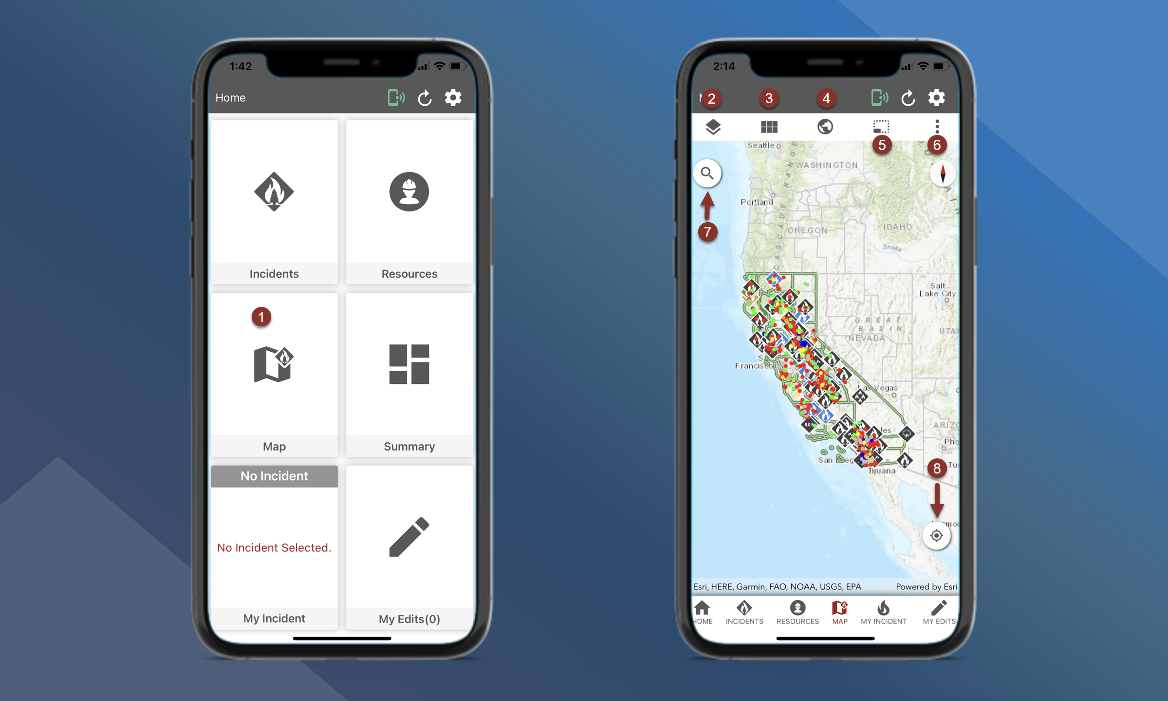
Main Map
Use the Main Map to see an overall picture of Incidents, Resources, and other information.
Users are not able to add mapping features, photos or files from this map. Users must navigate to the incident specific map.
Access the Main Map by tapping the Map button on the Home screen or by using the bottom navigation bar
Map layers
Basemaps
Zoom to Global Extent
Offline Basemaps
Perform other functions to improve Situational Awareness
Measure will allow you to calculate distance and area
3D View
Wx Station Data will allow you to select a point on the map to get weather data
Set Map Extent will allow you set the current view as the default map extent
Sync Resources will allow you to update all resources
Enable Keep My Location Active will allow you to always have your current location displayed on the map. Note that keeping your location active increases the battery consumption of the application. This feature is disabled by default.
Search the map - Use the red drop-down list to select what you want to search the map for:
Online will allow you to search for street addresses, cities, etc.
Incidents will allow you to search for Incidents
Resources will allow you to search for Resources
Lat/Lon will allow you to search by coordinates
Offline
Cameras
Zoom to current location

